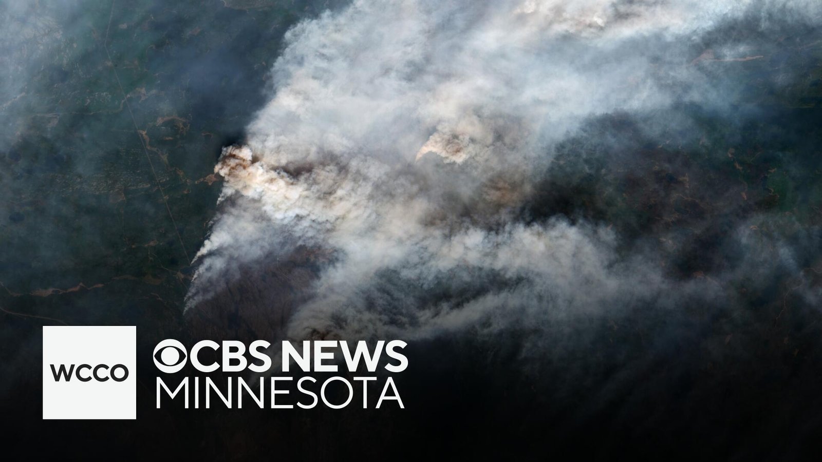
Smoke spreading from wildfires in Canada was affecting air quality in multiple states on Tuesday.
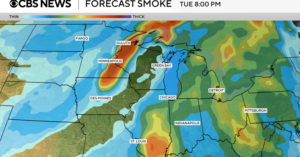
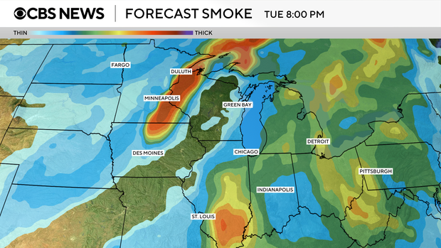
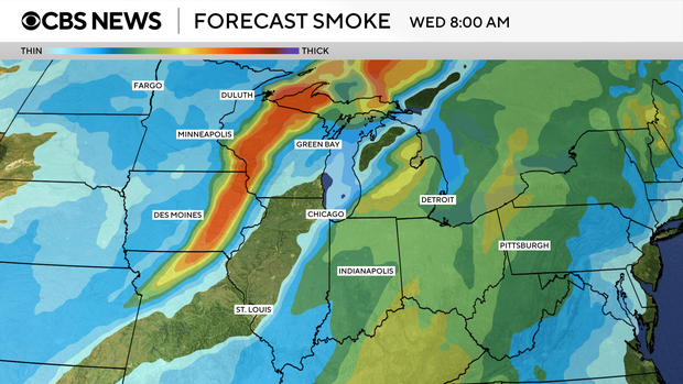
Parts of Minnesota, Iowa and Wisconsin were most at risk for unhealthy air, according to a federal measurement system called the Air Quality Index.
The index has six ratings: good, moderate, unhealthy for sensitives groups, unhealthy, very unhealthy and hazardous. Sensitive groups include those who have a heart or lung disease, as well as older adults, children and pregnant women.
The map below shows the current air quality across the U.S.
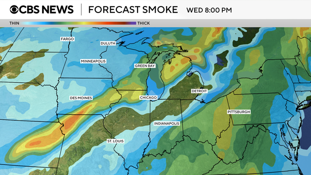
Other states, including Illinois, Michigan, Ohio, Pennsylvania and West Virginia, may see smoke from the fires, although the thickness will vary.
In the Philadelphia region, for example, while smoke is expected to be visible, no major impacts on air quality are expected, CBS Philadelphia reported.
Here’s a look at where the smoke is expected to move on Tuesday and Wednesday.
Around 200 active fires are burning in Canada, according to the Canadian Interagency Forest Fire Centre. More than 25,000 residents across three provinces had been evacuated due to the blazes as of Sunday, The Associated Press reported.
[ad_2]